Sea Level Rise VR Experience
The Problem
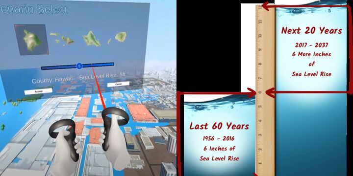
Our climate is changing and as the planet heats up, ice caps are melting, and ocean waters are staying warmer longer. With this increase in water supplies from melting ice, along with thermal expansion, sea level rise (SLR) is no longer a maybe - it is happening, and it is going to be a major threat to people’s livelihoods, critical coastal infrastructure, and coastal habitats including reefs and marshes very soon. According to the National Oceanic and Atmospheric Administration (NOAA) sea level is rising by an average of one inch every five years and the rate of rise is accelerating. Scientists predict that more than 150 million people are currently living on land that will be permanently under the high tide line by 2050. That is just 30 years from now. In the United States, 13 million people could become climate refugees from SLR that may reach 6 feet by the end of this century. Further, cities are going to need to move or rebuild critical infrastructure inland which will affect many millions more. This is not just a coastal community problem - no American will be left unaffected. In terms of conservation, a study conducted by the Center for Biological Diversity found that SLR poses a threat to 233 federally protected animals and 23 protected plant species in 23 states as water will submerge habitats and nesting sites. But the public and governments at large have failed to take significant, large scale actions to combat this issue.
Our Proposal
Coastal communities have several options to combat rising sea levels: shoreline infrastructure adaptations, managed retreat, rezoning, etc., however humans tend to react and respond only to crisis situations when it is at their doorstep, or when an emotional trigger is sparked. The predominant way to visualize sea level rise (SLR) scenarios and the resulting impact to critical infrastructure and coastal ecosystems are through 2D map viewers much like NOAA's Sea Level Rise Viewer. Unfortunately, the data that are shown in these SLR maps are not always intuitively understood. For example, a high rise building in a modeled inundation zone will go from having a building colored pixel to a blue pixel - but does that mean the 30-story building is completely underwater? What is the real extent of damage? Further these 2D maps rarely evoke strong emotional responses that are often the catalyst to prompt people to take action. Our solution is to create a realistic, immersive, virtual reality (VR) experience of SLR using real geospatial data, climate change projections, and 3D city environments to spark that, “We must do something about this now,” trigger. Having a city planner "experience" standing waist deep in water at her favorite sea side restaurant might just be what is needed bring home the devastating impacts of impeding SLR. We will use Unity to create a free VR-SLR experience for 1-10ft inundation scenarios for each coastal state the United States for the Oculus Quest.
We Assume that...
1. We assume that given real scientific data to appeal to logic and an immersive experience to appeal to emotions that we will be able to trigger behavioral changes.
Constraints to Overcome
We have done an extensive search, and currently, there are a few other virtual reality apps highlighting sea level rise however, existing ones focus on a single city, or just one extreme climate change scenario. Google Earth no longer offers an API for their 3D model, so another 3D rendering needs to be used. Until recently VR was also considered a fringe technology, but sales of the Oculus Quest soared in 2019 bringing VR into the mainstream. Getting GIS layers to play nice in Unity is also a challenge. We worked for weeks to find a solution to the problem and were eventually successfully able to create a pilot app for the State of Hawaii. We would like to scale this to include all state in the US.
Current Work
Our current pilot app uses Unity's 3D world and is limited to Hawaii. Our first task is to download and process the 1-10ft GIS layers for all coastal states in the US. Our second task is to explore different 3D map options to give the experience a more realistic feel.
Current Needs
Our team has a computer scientist, geographic information specialist, graphic designer, and a learning technologies specialist. We're well equipped in terms of skills. We need funding for two oculus quests, a license to global mapper. Previously we were using a Quest that belongs to a classroom that we no longer have access to. We would also like to team with someone who specializes in app branding or marketing.